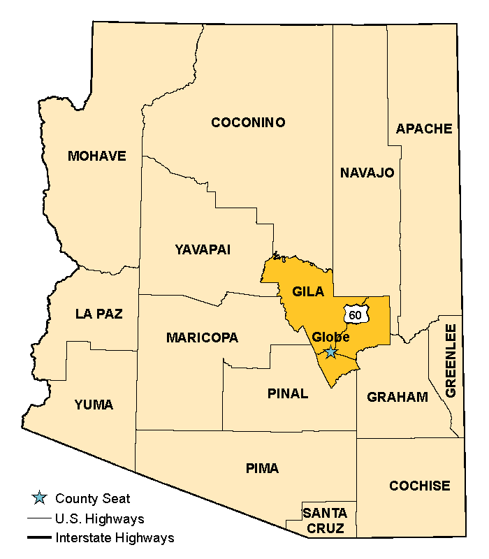


Gila County was created in 1881 from portions of Maricopa and Pinal counties, and later added part of Yavapai County. The county covers 4,796 square miles and is a source of great mineral wealth. Silver first attracted people to this area in the late 19th century. When the silver resources were depleted, copper emerged and has kept mining alive to this day. Globe is the county seat.
Gila County is the home of the legendary Graham-Tewksbury feud, which began in the 1870s and lasted 15 years. The fued started when the Graham family accused the Tewkbury family of stealing and rebranding the cattle of another rancher. The accusation led to hostility between the two families that escalated into bloodshed. It claimed dozens of lives and ignited tempers between cattle ranchers and sheep ranchers for years to come.
Some of the attractions in Gila County include the Salt River Canyon, Tonto National Monument, the Mogollon Rim, Tonto Natural Bridge State Park, Coolidge Dam, Roosevelt Dam and Roosevelt Lake. Both desert terrain and mountain ranges spread across the county’s landscape. Elevations range from 2,000 to 7,000 feet above sea level. This stark difference of 5,000 feet enables the county to support ranching as well as tourism and recreation. These three areas of commerce, in addition to copper production, comprise the county’s major industries.
The U.S. Forest Service owns 56 percent of the land in Gila County. Approximately 38 percent belongs to the Apache Tribe. Individuals and corporations own 2 percent of the land; the U.S. Bureau of Land Management, 2 percent; and the state of Arizona, 1 percent of the land; other public lands make up the remaining 1 percent.

| 2000 | 2010 | 2023 | |
|---|---|---|---|
| Arizona | 5,130,632 | 6,401,569 | 7,285,370 |
| Gila County | 51,335 | 53,565 | 53,525 |